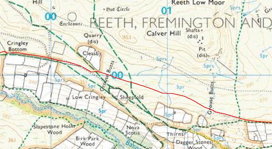
Around 0.4 miles from Cringley Bottom the track forks (there is a large
sheep fold to the left of the path) and the official route starts to descend.
If you bear left at this point then a good track (not marked on the maps
but visible on Google Earth) rejoins the official path without the need
to descend and re-ascend. (Red line on map below).
|
|