The Pennine Way is well
marked on the 1:25 000 Ordnance Survey maps. However to cover the complete route
then you will need to buy and take with you an awful lot of individual maps! I
downloaded the whole of the route in 2km square sections free from the
Ordnance Survey Get-a-Map service and then 'stitched' these together into
convenient A4 size chunks. I printed these off and carried them with me in a
couple of plastic A4 wallets. These are ideal when you are walking especially if
it is windy or wet.
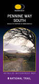
Harvey's produce three very good maps covering the whole of the
Pennine Way
I took this guide, by Keith Carter and Edward de la Billiere, with me. I found it particularly useful as it
was easy to dissect into three sections so I only ever carried part of it!
Lots of useful information.
I also found these overview maps of the Pennine Way published by Footprint
useful on the journey especially as they are light to carry.